About HARPIS-SL
Hazard And Risk Profile Information System – Sierra Leone (HARPIS-SL) integrates Geographic Information Systems (GIS) and Management Information System (MIS) systems and mobile data collection technology to provide a family of sophisticated tools and Web services for collecting, managing, visualizing, mapping, analysing, monitoring, evaluating and reporting on various aspects of disaster risks, hazards, vulnerability, exposure and disaster management in Sierra Leone. This integrated and holistic platform puts the HARPIS-SL on a more sturdy foundation. The ability of the ONS-DMD and various stakeholders to make sound disaster risks, hazards, vulnerability, exposure and disaster management decisions can be greatly enhanced by the cross-sectoral integration of information within the HARPIS-SL.
HARPIS-SL has been designed and developed by INTEGEMS under the UNDP sponsored "Update of Sierra Leone Hazard Profile and Capacity Gap Analysis Project". The Project’s main objective is to establish a National risk profile.
Read more
 |
HARPIS-SL has been designed and developed by INTEGEMS under the UNDP sponsored "Update of Sierra Leone Hazard Profile and Capacity Gap Analysis Project". The Project’s main objective is to establish a National risk profile.
Read more
Below are the number of hazards assessed in HARPIS -SL and the disasters figure accounts for all the disasters registered on Desinventar and EMdat.
14
Hazards
9
Natural Hazards
5
Man Made Hazards
1203
Disasters
National Hazard Assessments
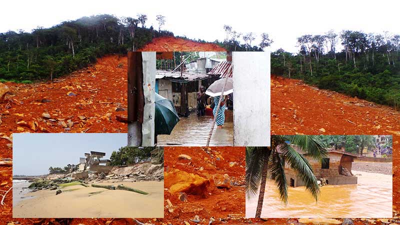
In Sierra Leone, floods, epidemics, landslides, tropical storm, coastal erosion, sea level rise, droughts and thunder and lightning are the main natural hazards that generate disasters. These natural disasters have caused loss of life, and enormous damage and destruction to property.
Sea Level Rise
Sea level rise hazard profile development used the worst case scenario of maximum level of sea rise of about 59 cm in 100 years predicted in 2007 by the Intergovernmental Panel on Climate Change (IPCC]. However, literature indicates high uncertainly in sea-level rise predictions due to the lack of understanding of the dynamics of ice sheets, glaciers and oceanic heat. The accuracy in the modelling of sea level rise depends on two parameters namely the accuracy of sea level prediction and accuracy of ground level heights.
Learn More
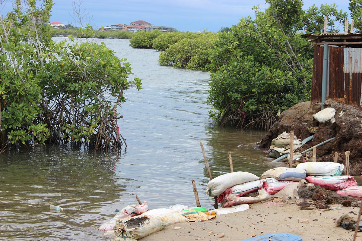
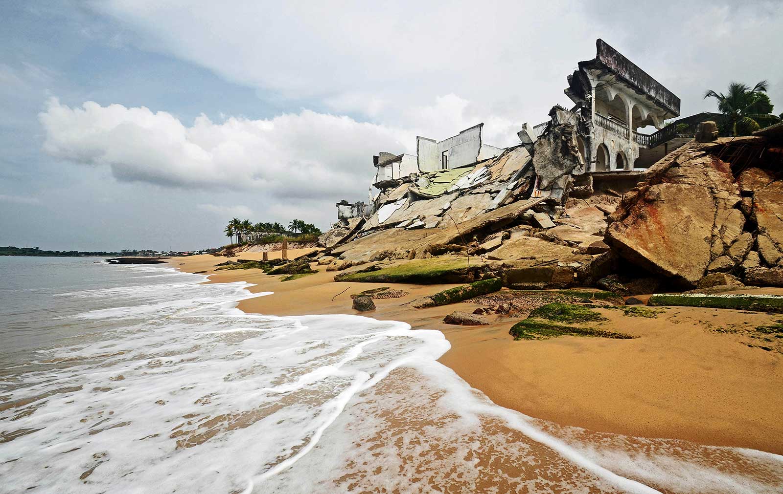
Coastal Erosion
Coastal erosion in Sierra Leone is accelerated due to anthropogenic activities and poorly planned coastal infrastructure development adding stresses on the coastal ecosystems. The complex coastal environment processes and shoreline stability or the dynamics of accretion or erosion are driven by coastal hydrodynamics, sediment balance and coastal geomorphology etc. influenced by wave climate and shoreline geometry.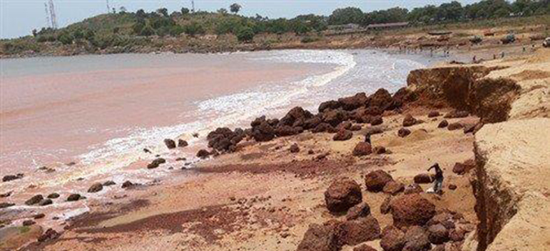
The coastal erosion hazard profile uses a sediment cell approach that considers wave incident angle, sediment balance and length of the cell on the shoreline stability. The coastal erosion driver significances have been adjusted in the study using the coping capacities corresponding to each cell, based on the physicalcoast protection structures. The final rank of the degree of erosion in each cell was determined in a reference scale. The coastal erosion profile is useful for designing setback systems in coastal management and strategic planning bearing in mind the uncertainties associated in modelling and data limitations.
Learn More
The coastal erosion hazard profile uses a sediment cell approach that considers wave incident angle, sediment balance and length of the cell on the shoreline stability. The coastal erosion driver significances have been adjusted in the study using the coping capacities corresponding to each cell, based on the physical
Learn More
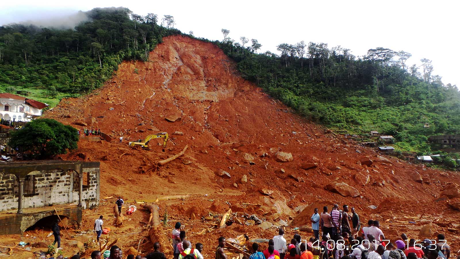
Landslides
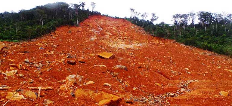
Slope failures are becoming more widespread, and have over the years caused more human, socio-economic, and environmental losses than any other geologic hazard in Sierra Leone. Landslides, mudslide, and rockfall (hereafter landslides) is a general term covering a wide variety of mass movements and processes involving
Learn More
Drought
Drought is a result of extreme negative rainfall anomalies. Drought management strategies in vulnerable regions involve reduction of drought risk and targeting resources by better understanding the spatial and temporal variability of drought proneness. Drought hazard profile was developed by combining rainfall and evapotranspiration related indices derived from yearly and monthly data series. 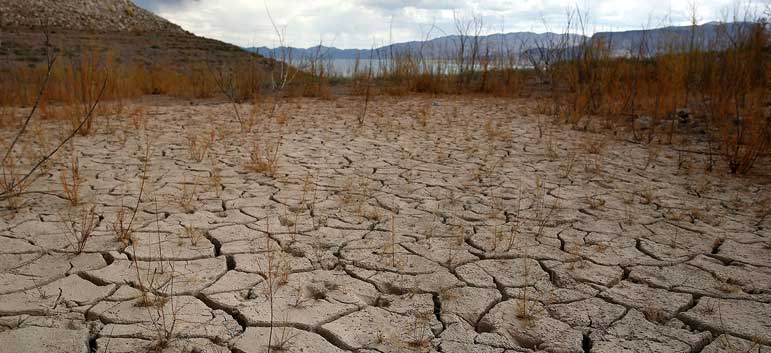
The drought hazard profile is helpful in formulating climaticzone based management strategies and plan activities to mitigate drought impacts. Application of drought profile may include sustainable land and water use practices combined with early warnings, drought relief and insurance, etc. Inputs of scientists in soil-water-plant related policy interventions is also critical. The future population growth along with anticipated rapid development will add more pressure to water resources in all climatic zones, therefore important, beyond the level of water demand considered in the assessment.
Learn More
The drought hazard profile is helpful in formulating climatic
Learn More
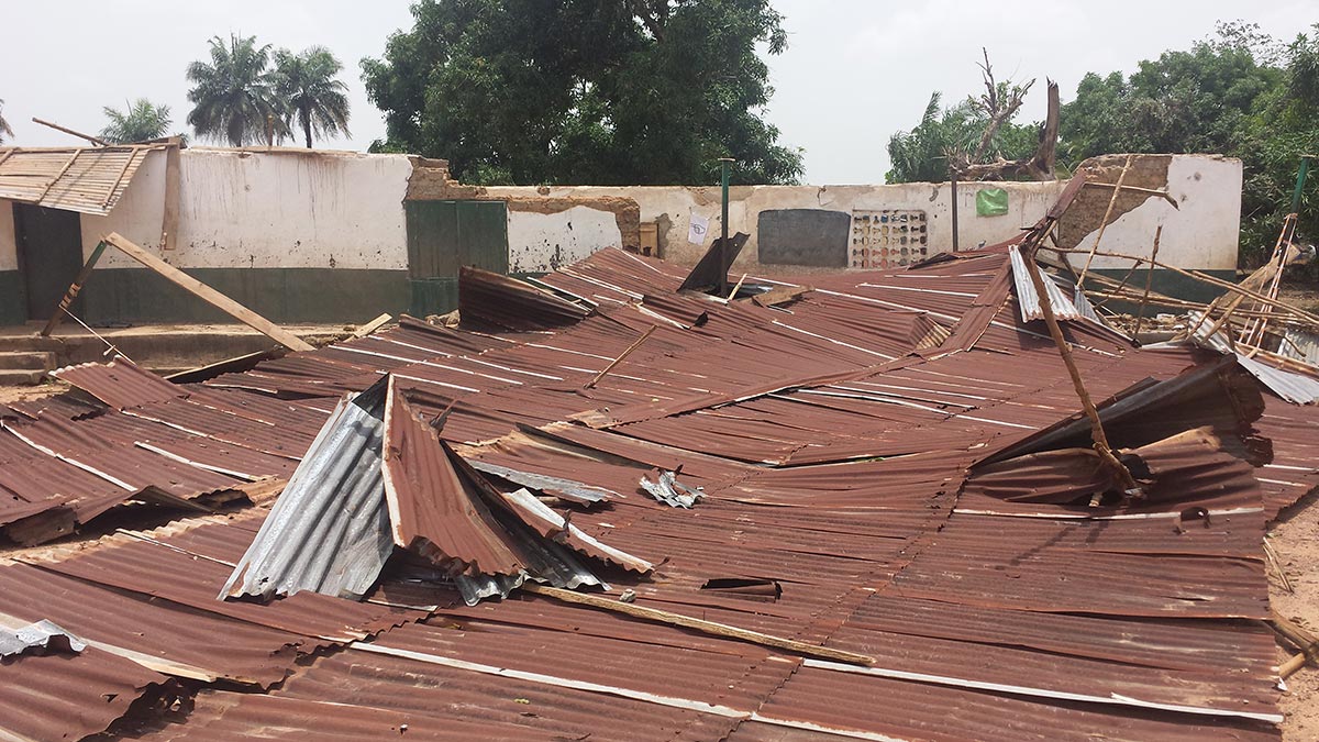
Tropical Storm
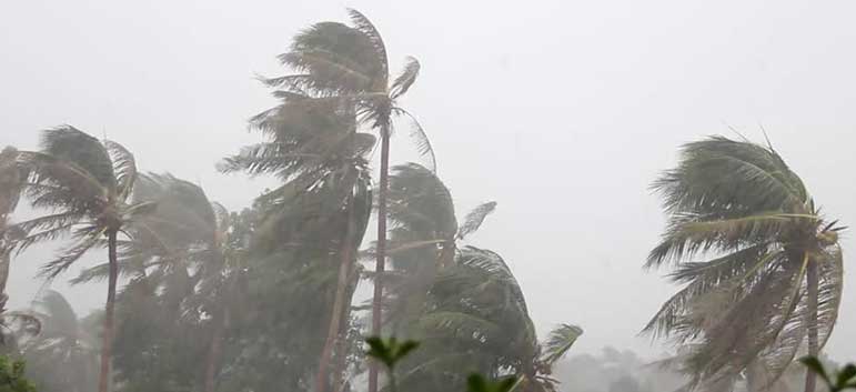
Tropical storms are a part of tropical weather systems and has the potential to produce strong winds along with torrential rainfall and associated storm surge near the centre of the storm. Tropical storms can also be very destructive to coastal communities, infrastructure and ecosystems. The tropical storm hazard profile is expected to guide the formulation of disaster management practices and procedures, improve preparedness and target resources for disaster risk reduction.
Learn More
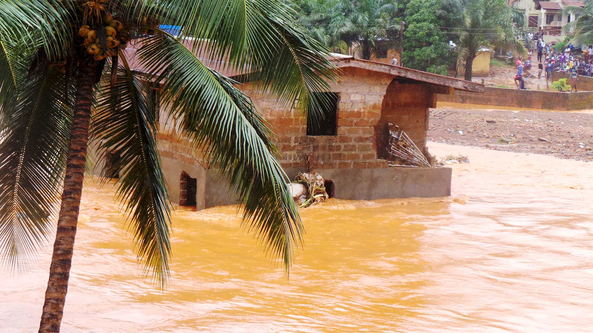
Flood
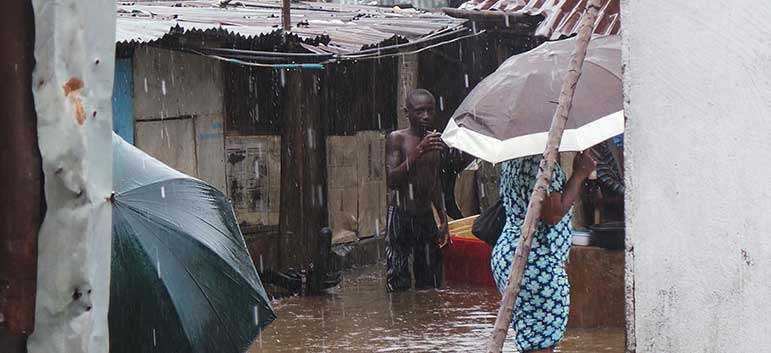
In this flood hazard profile development computation of inundation areas for different return periods using digital elevation model (DEM) based hydrologic
Learn More
Lightning and Thunder
Sierra Leone is more vulnerable to lightning and thunder due to more convective activities triggered by direct incidence of solar energy to the Earth surface. Life time of a lightning flash is about 20 milliseconds but it carries energy in the order of megawatts and currents ranging from 30,000 to 200,000 Amperes humans or property through. 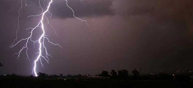
Modes of lightning strike include side flash, contact potential, step potential and surge propagation of lightning causes property damages and down time in data and communications are significant. In the lightninghazard profile data from eight AWS were collected and analysed for spatial and temporal distribution lightning events. Potential regions with high frequency for lightning were identified.
Learn More
Modes of lightning strike include side flash, contact potential, step potential and surge propagation of lightning causes property damages and down time in data and communications are significant. In the lightning
Learn More
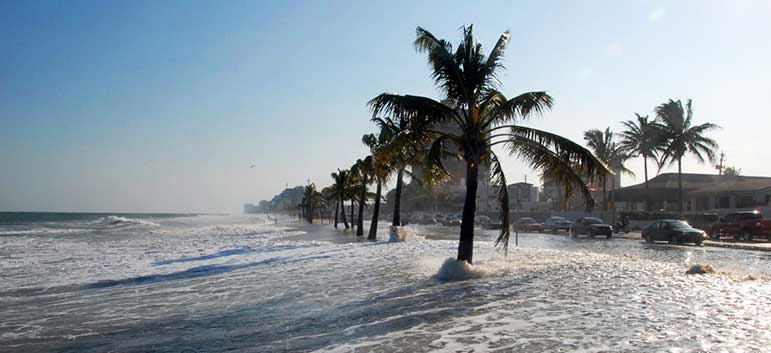
Storm Surge
Damage to life and property due to tropical storm-induced storm surges occur as a result of inundation of low-lying lands in the shore. Storm surge is primarily originated by pressure induced on ocean surface by high winds resulting in an unusual rise in water level causing coastal flooding.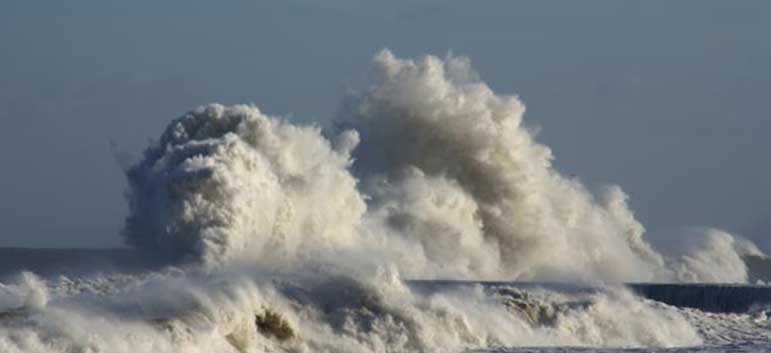
A statistical analysis of past storm surges was performed to derive cyclone scenarios with respective recurrence intervals for the purpose of storm surge hazard assessment. The probable extent of onshore inundation due to the range of tropical storms was not conducted due to lack of good quality data for input to a multi-scenario analysis using the MIKE21 Flow Model. The model uses a depthaveraged, non-linear equations of conservation of mass and momentum to simulate tropical storm induced storm surges.
Learn More
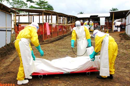
Epidemics
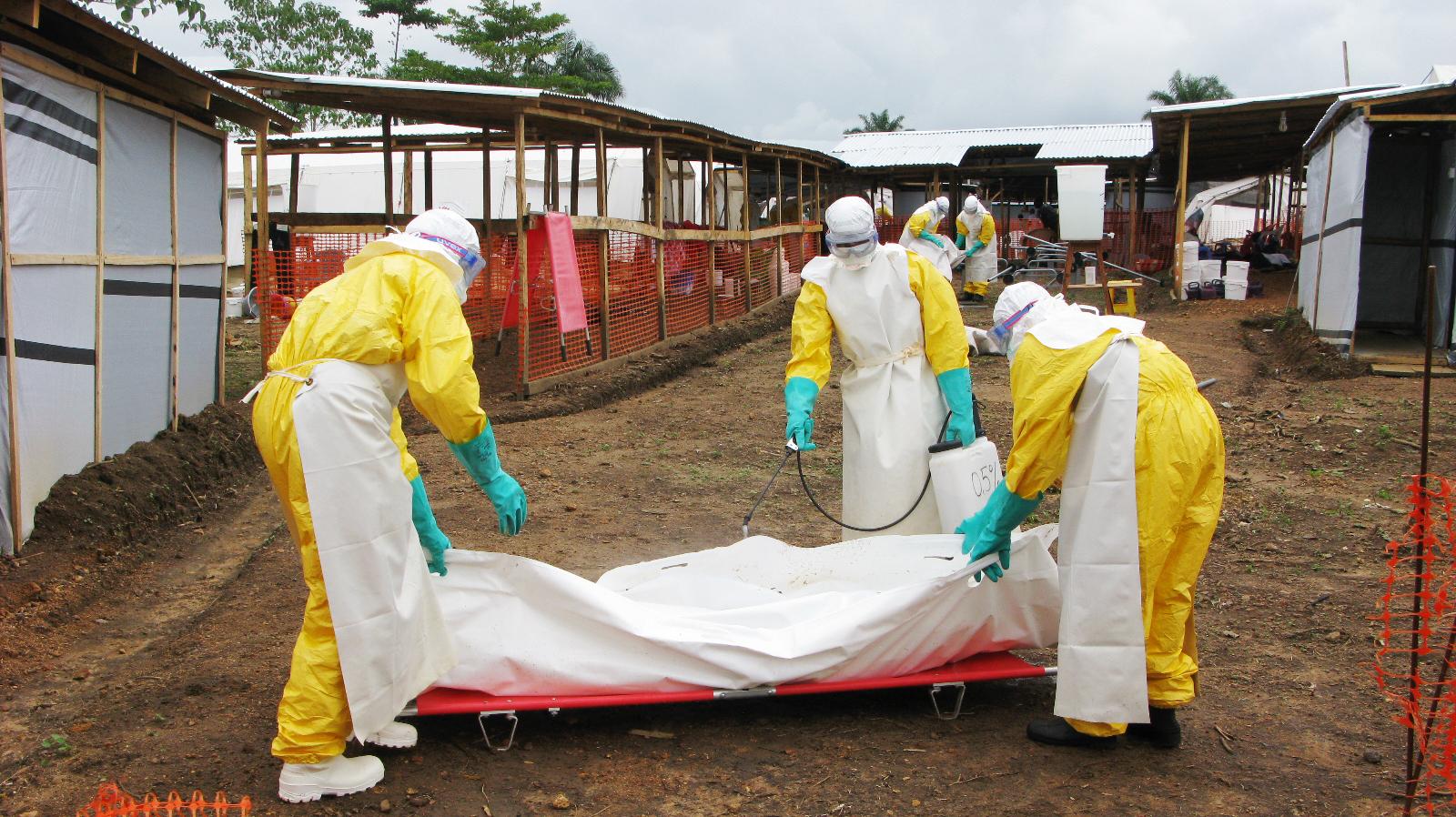
The effects of epidemics on Sierra Leone’s human and economic resources is unparalleled by any other form of disasters from natural hazards. The Ebola Virus Disease (EVD) which broke out in Sierra Leone in 2014 is the most overwhelming disaster the country has faced in its post-conflict era. More than 14,000 Sierra Leoneans were infected, of whom nearly 4,000 died.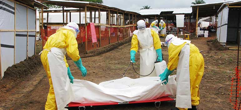
The unprecedented emergence of Ebola Virus Disease (EVD) in Sierra Leone placed enormous strains on national systems and on the resources and capacities of the government to cope with the public health crisis. The rapid spread of EVD, from isolated outbreaks in Kailahun and Kenema, to all thirteen districts of the country demanded the introductory of extraordinary measures to contain the epidemic, including the declaration of a State of Emergency and special security powers to quarantine affected areas, place restrictions on internal movement, close markets and schools and reduce public gatherings .
Learn More