In the landslide hazard profile, hazard maps were prepared using relative contribution of causative factors, namely, geology, lithology, slope angle, soils and land cover along with assigned weights and ratings based on their relative contribution. 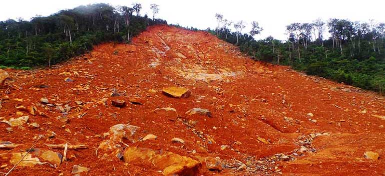
Landslides cover
The weights and ratings have been decided on considering expert opinion and statistical analysis of historical data. Considering the complex nature of landslide potential decided based on the variations of causative factors the predicted landslide hazard maps are expressed more in descriptive terms such as landslides are most likely to occur. Landslide hazard maps are useful in planning human settlements, infrastructure and other development activities and investments in mitigation.
|
Parameters |
Landslide Hazard Profile Scale |
||||
|
1 |
2 |
3 |
4 |
5 |
|
|
Frequency |
Very Rarely |
Rarely |
Sometimes |
Often |
Frequently |
|
Magnitude |
Trivial |
Small |
Moderate |
Large |
Very Large |
|
Duration |
Very Short |
Short |
Average |
Long |
Very Long |
|
Areal Extent |
Limited |
Very Sparsely |
Sparsely |
Densely |
Widespread |
|
Spatial Predictability |
Highly Predictable |
Predictable |
Likely |
Randomly |
Very Randomly |
|
Speed of onset |
Very Slow |
Slow |
Moderate |
Fast |
Very Fast |
|
Importance |
Not Important |
Somewhat Important |
Moderately |
Important |
Very Important |
|
Spatial Dispersion |
Very Concentrated |
Concentrated Moderately |
Moderately |
Diffused |
Widely Diffused |
|
Area/District |
Frequency Scale |
Magnitude Scale |
||||||||
|
1 |
2 |
3 |
4 |
5 |
1 |
2 |
3 |
4 |
5 |
|
|
Western Area |
|
|
|
|
|
|
|
|
|
|
|
Bo |
|
|
|
|
|
|
|
|
|
|
|
Bonthe |
|
|
|
|
|
|
|
|
|
|
|
Moyamba |
|
|
|
|
|
|
|
|
|
|
|
Pujehun |
|
|
|
|
|
|
|
|
|
|
|
Bombali |
|
|
|
|
|
|
|
|
|
|
|
Port Loko |
|
|
|
|
|
|
|
|
|
|
|
Tonkolili |
|
|
|
|
|
|
|
|
|
|
|
Kambia |
|
|
|
|
|
|
|
|
|
|
|
Koinadugu |
|
|
|
|
|
|
|
|
|
|
|
Kenema |
|
|
|
|
|
|
|
|
|
|
|
Kono |
|
|
|
|
|
|
|
|
|
|
|
Kailahun |
|
|
|
|
|
|
|
|
|
|
[1] Prevention Web Sierra Leone Disaster and Risk Profile (http://www.preventionweb.net/countries/sle/data/, accessed 14 July 2017) [2] A thunderstorm or other violent disturbance of the electrical condition of the atmosphere. [3] Sierra Leone: Flash Update OCHA West & Central Africa. (2015). (https://reliefweb.int/report/sierra-leone/sierra-leone-flash-update-ocha-west-central-africa-15-august-2017, accessed 9 September 2017) [4] Tarawalli, P. (2012). Diagnostics Analysis of Climate Change and Disaster Management in Relation to the PRSP III in Sierra Leone. Freetown: UNDP - SL. [5] Tarawalli, P. (2012). Diagnostics Analysis of Climate Change and Disaster Management in Relation to the PRSP III in Sierra Leone. Freetown: UNDP - SL.